Sheared Margins of Western Australia, Phase 1 Supplement
Principal investigator: Michal Nemčok, Ph.D. | John Conolly, Ph.D.
Investment: US $25,000
Status: Completed | Immediate Delivery Report Number I 01069_2
Cost for sponsors: $80k (USD)
The result of this study is the Arc GIS project (Arc Map v. 10.3), which contains:
a) 10 horizon depth maps in milliseconds of TWT (Moho, top Middle Jurassic, base Barrow Delta, top Barrow delta, stretching unconformity, thinning unconformity, Aptian/Albian boundary, top Turonian, Cretaceous/Tertiary boundary, sea floor)
b) 8 sedimentary (resp. rock) thickness maps in milliseconds of TWT including:
(1) thickness between Moho and top of the crust for the entire study area with thinner continental crust
(2) thickness between Moho and Middle Jurassic top for the outer portion of the Exmouth Plateau
(3) thickness of Barrow Delta and its local stratigraphic equivalents
(4) thickness between top Middle Jurassic surface and stretching unconformity for the Exmouth Plateau and Argo margin segments
(5) thickness between top Middle Jurassic and top Turonian surfaces for the Exmouth Plateau and Argo margin segments
(6) thickness between stretching unconformity and top Turonian surface for the Exmouth Plateau and Argo margin segments
(7) thickness between top Turonian and Cretaceous/Tertiary boundary for the Exmouth Plateau and Argo margin segments
(8) thickness between Cretaceous/Tertiary boundary and sea floor for the Exmouth Plateau and Argo margin segments
c) fault activity timing map (pre-Late Jurassic, pre-Aptian/Albian boundary, pre-Cretaceous/ Tertiary boundary and Tertiary faults)
d) 4 maps of unconformable and conformable portions of key horizons (top Middle Jurassic, Aptian/Albian boundary, top Turonian, Cretaceous/Tertiary boundary horizons)
e) 6 maps of color-coded missing age span associated with erosional unconformities determined in wells (Middle Jurassic, Upper Jurassic, Lower Cretaceous, Aptian/Albian boundary, Turonian, Cretaceous/Tertiary boundary erosional events)
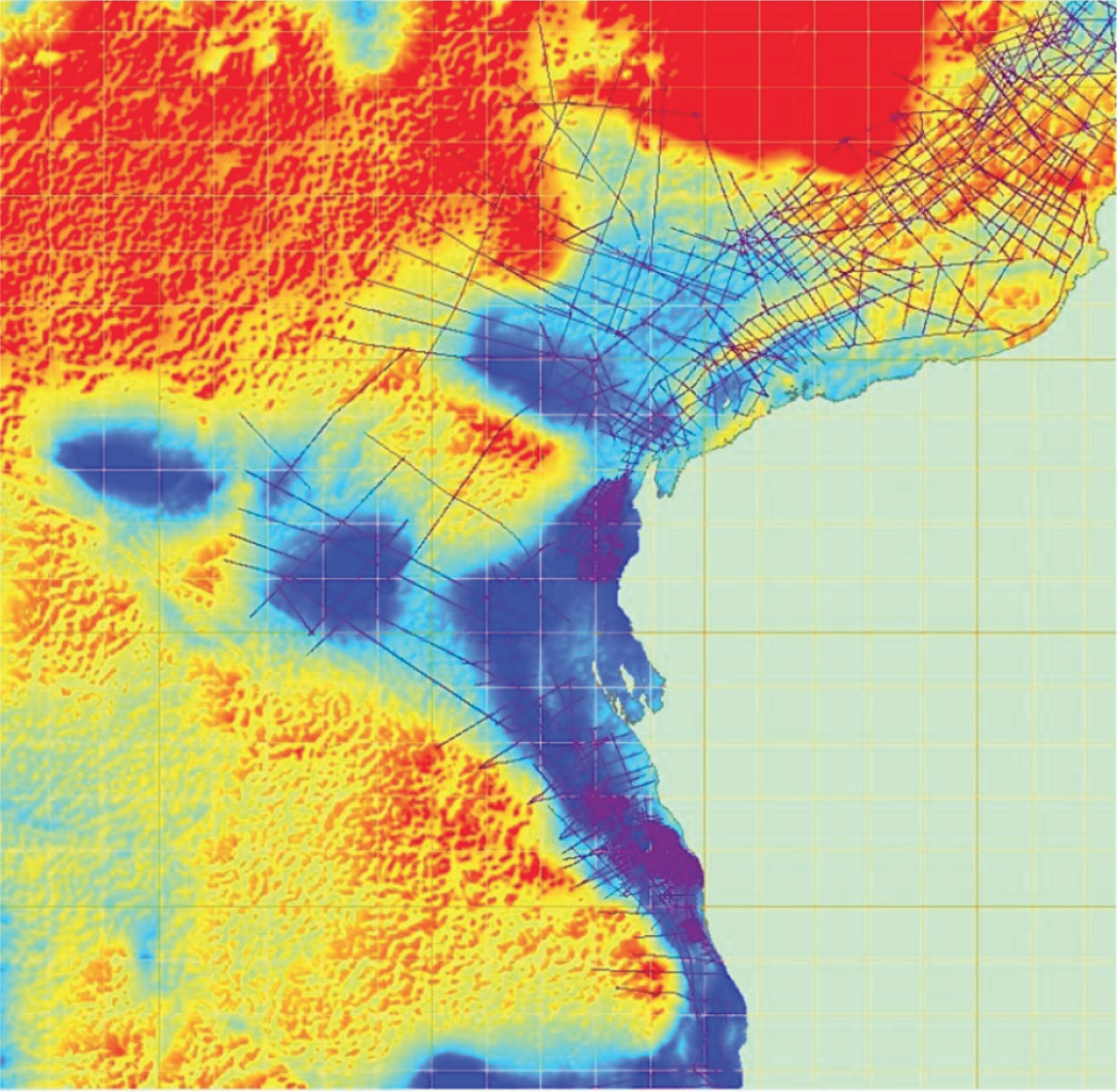
Study area includes West Australian margin segments spanning from the Argo rifted margin segment in the north to the Perth rifted margin segment in the south, including the Exmouth Plateau, Cuvier obliquely-rifted margin segment, Wallaby Plateau, Zenith Plateau and Zenith-Wallaby-Perth transform margin segment.
CONTACT TO PURCHASE
Michal Nemčok, Ph.D. | +421-2-2062 0781 | mnemcok@egi.utah.edu
John Conolly, Ph.D. | Australia Tel. 61-2-4862 3311 | john.conolly@bigpond.com
Phone: 801-581-5126
ContactEGI@egi.utah.edu
egi.utah.edu
SUMMARY
Outer frontier margins of Western Australia are characterized by stranded continental blocks and marginal plateaus. Sedimentary section is prospective in Permian, Triassic, Jurassic and Cretaceous marine sequences with potential oil source rocks and siliciclastic reservoirs. Potential traps extend over 2500 km of under-explored Western Australian margin. This study will open minds to new plays over a vast region of Australian waters. Studying the spatial and temporal distribution of fault activity, burial minima, erosional unconformities and missing strata allows one to interpret:
1. Which eroding structures were footwall edges and which were horsts
2. Which structures did not have a top seal and for which time span
3. Which positive topographic features must have been hydrocarbon migration destinations and for which time span
4. Where were the main sediment entry points into the deeper basins (i.e., the main input of the reservoir-rock prone sediment)
5. Where were the main sediment distribution pathways in the deeper basins (i.e., the main zones of the reservoir-prone sediment)
6. Which sediment catchment areas were separated by positive topographic features from any potential reservoir-prone sediment input (i.e., areas prone to seal and source rock deposition).

Map of the study area showing offshore isostatic residual gravity anomalies, which were calculated during Phase 1 study, and locations of interpreted reflection seismic data accessed from the Geoscience Australia.
