RED SEA AND GULF OF SUEZ BASINS
Principal Investigator: Rasoul Sorkhabi, Ph.D.
Status: In Development | Report Number I 01400
Cost for sponsors:
EGI’s processed seismic sections (>600 SGY files) and well logs (>400 LAS files) from Egypt and Gulf of Suze.
An ArcGIS database of regional maps, integrated stratigraphic charts of wells, geochemical data, and paleofacies maps of the Red Sea and Gulf of Suez basins.
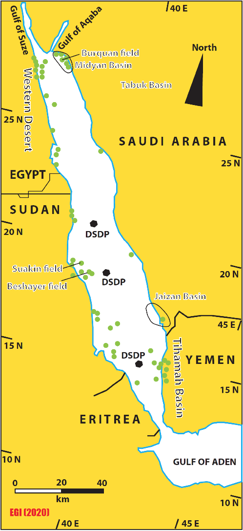
The ArcGIS database offers a quick survey tool as well as evaluation of pre-salt (pre- Late Miocene) and pre-rift (Jurassic-Eocene) sedimentary packages and petroleum plays in the Red Sea basin. The stratigraphic and associated geochemical data are standardized by correlation of the geology of the complex region bordered by six different countries (Egypt, Saudi Arabia, Sudan, Yemen, Eritrea, and Djibouti).
A better understanding of the tectono-sedimentary evolution of the Red Sea and Gulf of Suez basins for petroleum exploration with a focus on key petroleum systems elements from source rocks to traps.
An ArcGIS quick assessment and easy-to-use tool for analysis of petroleum plays in the region based on an integrative database that can be augmented to the internal databases of the sponsoring companies. This would help to assess data-poor frontier or deeper plays based on regionally correlatable plays.

SUMMARY
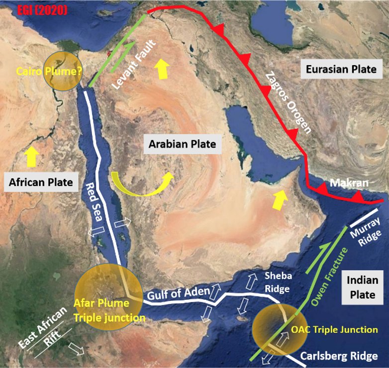
The Red Sea rift basin runs for 2,250 km in a NNW-SSE trend between the African and Arabian plates, and in connected to the Gulf of Suez basin in Egypt.

CONTACT TO PURCHASE
Rasoul Sorkhabi, Ph.D.| rsorkhabi@egi.utah.edu
Eiichi Setoyama, Ph.D. | esetoyama@egi.utah.edu
Phone: 801-581-5126
egi.utah.edu
