Value to Sponsors:
- Recalibration of the stratigraphy and evaluation of petroleum systems of the Central & North Atlantic Ocean conjugate margin.
-
Timely opportunity to leverage a carefully selected array of 40 wells: COST – Continental Offshore Stratigraphic Test plus commercial wells and DSDP-ODP-IODP sites, recommended by EGI corporate members.
-
Both in-house and affiliate scientist expertise and partnerships with 8 international institutes.
-
Unique world class capability in high resolution chronostratigraphy via composite standards calibrated to the 2012 time scale, and novel analytical techniques in petroleum geochemistry (e.g., RockEval 6, kinetics, palynofacies).
-
ArcGIS delivery platform.
EGI Oceans – C & N Atlantic Petroleum Systems I01229
Investment:
40 Graphic Correlation Charts Linked to Respective Well Locations
40 Integrated Geochemical Well Summaries Linked to Respective Well Locations
7 Chronostratigraphic Cross Sections Linked to Cross Section Locations
13,219 Organic Geochemistry Sample Data Results (All Geo-referenced):
12,495 Organic Geochemistry Sample Data from Literature (Curated)
722 New TOC Analyses (Analyses Commissioned by EGI Oceans)
583 New Pyrolysis Analyses (Analyses Commissioned by EGI Oceans)
72 Samples from 18 Sites/Wells with Palynofacies Results
569 Pyrograms Linked to Respective Organic Geochemistry Sample Locations
14 Samples from 6 Wells with New Vitrinite Reflectance Analyses
VR Summary Sheets Linked to Respective Organic Geochemistry Sample Locations
22 Samples from 12 Wells with Bulk Kinetics Analysis Results (4 models per sample)
Original Bulk Kinetics Data Results and Graphs Linked to Bulk Kinetics GIS Layer
3 Samples from 3 Wells with Compositional Kinetics Results (Geo-referenced)
Source Rock Evaluation Interpretation for EGI Oceans Region 2 Wells GIS Layer
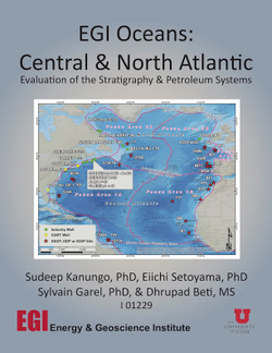
This study has devised and applied an integrative workflow involving chronostratigraphy, paleoenvironment, pyrolysis, palynofacies, and kinetics to qualify the source rock systems of the Central and North Atlantic conjugate margins (Figure 1). The project has established a unified high-resolution (+/- 0.5 Ma best resolution) Mesozoic and Cenozoic chronostratigraphy with the delineation of regional unconformities for the 41 stratigraphically deepest available DSDP-ODP-IODP sites, industry, and COST wells that display four stratigraphic intervals with source rock potential on a regional scale. These intervals have been characterized in considerable detail for source rock properties such as richness, quality, preservation, maturity and kinetic parameters (Figure 2). A new organic matter end-member classification is proposed for the Central and North Atlantic source rocks with two categories that have not been described previously from the studied areas. The Gas-Oil Ratio (GOR) and Source Potential Index (SPI) were calculated through mass balance equations considering the net thickness of each of the identified source rock intervals, and used as a ranking metric to high-grade the basins and focus areas evaluated herein.
Sector I: Central Atlantic Ocean
Delimited by the Sierra Leone Fracture Zone in the south, and the Newfoundland Azores Fracture Zone (NAFZ) in the north. Includes conjugate margins of the east coast of the USA and West Africa (Morocco to Senegal).
Sector II: North Atlantic Ocean
Delimited by the NAFZ in the south, and the Davis Strait/Greenland Iceland Faroe Rise in the north. Including key areas of offshore eastern Canada (Scotian Margin, Newfoundland & Labrador Sea) and its conjugate in the Rockall/Porcupine Trough, Iberia and Bay of Biscay, this is a subsequently rifted segmented of Jurassic age dominated by Upper Jurassic (Kimmeridgian) source rocks.
Stay in Contact with EGI
Hours of operation
8:00 AM to 5:00 PM
Monday through Friday
Contact us
Address
Energy & Geoscience Institute
423 Wakara Way, Suite 300
Salt Lake City, UT 84108
Phone
801-581-5126
